Kailasgad
Range
Kailasgad
Altitude
1005m
Difficulty
Medium

Explore Offline
Download the app for 3D offline navigation, interactive trail maps, and emergency SOS tools.


About Kailasgad
Kailasgad Fort
Best time to visit
All year round / Check local forecast
Places to See
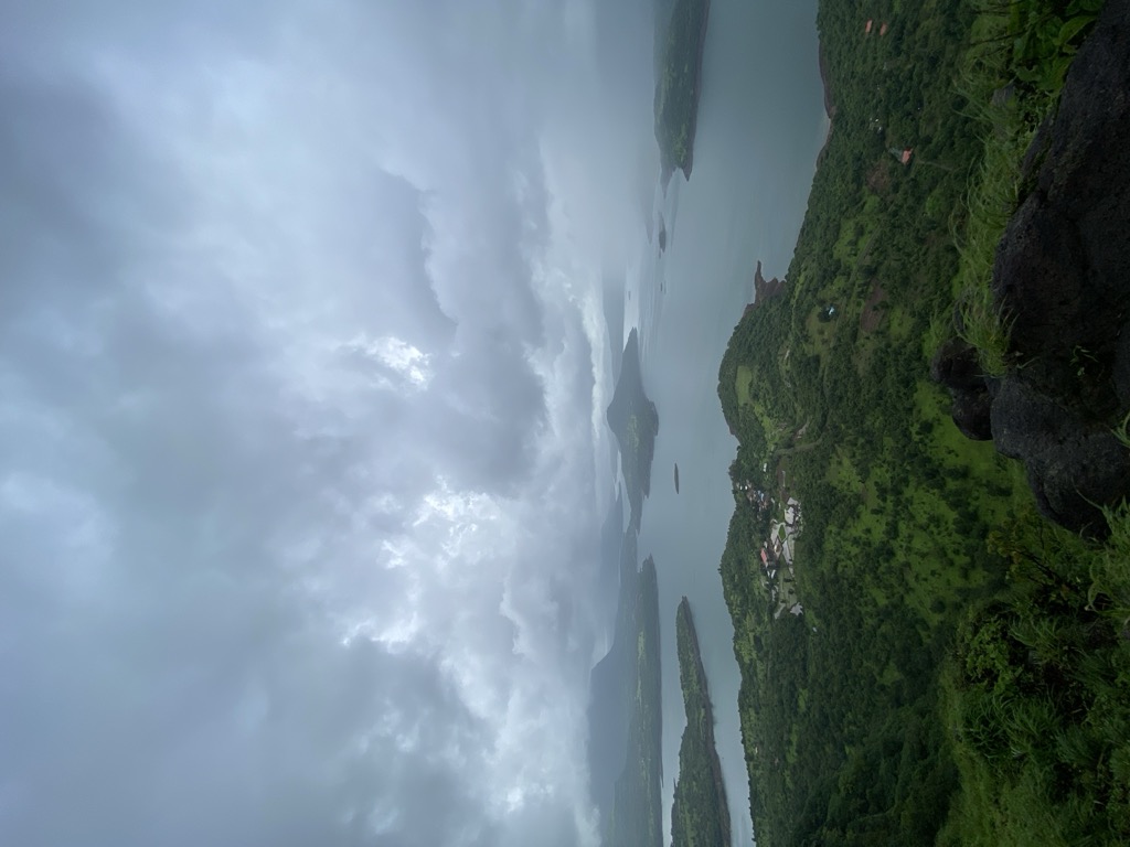
Trail Highlights & Routes: * **Viewpoint (15 min):** Follow the unpaved road near the signboard up a small hill. Get clear views of Mulshi Dam backwaters. * **Fort Ascent (30 min total):** From the viewpoint, continue along the joint hill (15 min, keep hill right/valley left). Traverse the mountain wall (15 min, keep fort right/valley left) to reach the fort plateau, marked by a saffron flag. * **Water Tanks (5 min detour):** Before ascending the small hill structure opposite the plateau, take the left route down for 5 min to see rock-carved water tanks (note: carving was unfinished due to soft rock). * **Fort Ruins:** Returning to the plateau, pass the small hill structure to find ruins of houses. * **Shivlinga & Descent:** At the fort's edge, find a wall with a carved stone Shivlinga. * **Descent Options:** 1. Return via the ascent route. 2. Take the route near the Shivlinga: an unpaved path descends towards Bhadaskonda village, leading further to the Vaduste – Tamhini road. * **Waghdev Temple:** Near the Vaduste – Tamhini road, visit the temple dedicated to Waghdev. Look for the natural cave carved out above. * **Cleft (10 min):** Continue on the tar road for 10 minutes to reach the cleft.
Journey & Transport
Time to Reach
1 hour from base
How to Reach
Ways to Reach Kailasgad Fort **Option 1: Via Vaduste Base Village** * **Access Route:** Mumbai → Lonavla → Bhushi Dam → INS Shivaji → Peth Shahapur → Vaduste. * **Distance:** Vaduste is 51 km from Lonavla. * **Transport:** S.T. buses available from Lonavla to Vaduste. * **Further Travel:** Road continues to Tamhini Ghat, Mulshi, and Pune. * **Trek Start:** 2 km past Vaduste, look for a cleft with an electricity transformer (left/Dam side) and the Kailasgad fort ridge (right). A signboard marks the trail. * **Trek Time:** About 1 hour to reach the fort from the signboard.**Option 2: Via Pune** * **Access Route:** Pune → Mulshi → Tamhini Ghat → Bhadaskonda. * **Distance:** Fort is 78 km from Pune on this route. * **Trek Start:** The cleft (fort access point) is located after Bhadaskonda village.
Facilities
- StayNo lodging on site.
- FoodNo Food Facility On-Site
- WaterWater on site is not drinkable.