Pin Parvati Pass
Range
Great Himalayan Range (Crossing from Pir Panjal to the Zanskar Range)
Altitude
5319m
Difficulty
Hard

Explore Offline
Download the app for 3D offline navigation, interactive trail maps, and emergency SOS tools.


About Pin Parvati Pass
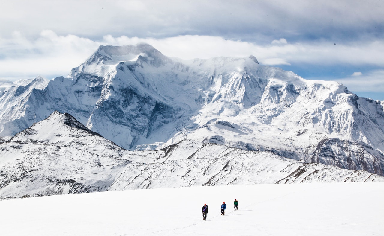
The Pin Parvati Pass is considered the holy grail of crossover treks in the Indian Himalayas, reserved for experienced trekkers. It is an epic, 110-km trans-Himalayan expedition that bridges two entirely different worlds. The journey begins in the dense, monsoon-fed forests and lush meadows of the Parvati Valley. Over several days, the landscape slowly shifts into massive boulder fields and expansive alpine moraines before reaching the spiritual, glassy waters of Mantalai Lake. The climax is an extreme, highly technical ascent across heavily crevassed glaciers to cross the pass at a staggering 17,450 feet. Once crossed, you descend into the stark, vivid, and colourful barren landscape of the Pin Valley in the Spiti region.
Best time to visit
July, August, September
History & Significance
Discovery: The pass was first mapped and crossed in 1884 by Sir Louis Dane (an English explorer and official) who was seeking an alternate route to the Spiti Valley. • Trade Impracticality: While traditionally explored as a shortcut, its extreme altitude, treacherous glacial crevasses, and heavy snow cover prevented it from ever becoming a viable trade route for locals or livestock, leaving it as a pristine corridor for hardcore adventurers. • Mythological Importance: Mantalai Lake, situated right below the pass on the Kullu side, is revered as the sacred source of the Parvati River and holds deep mythological connections to Lord Shiva and Goddess Parvati.
Places to See
Kheerganga hot springs, Tunda Bhuj (where the tree line ends), Mantalai Lake, the sprawling Pin Parvati Glacier, Pin Valley National Park (famous for snow leopards and ibex), and the picturesque, multi-hued village of Mudh.
Journey & Transport
How to Reach
To the Hub: Arrive in Bhuntar via flight (Kullu-Manali Airport) or an overnight Volvo bus from Delhi/Chandigarh. • To the Base (Start): From Bhuntar, take a local bus or taxi to Barshaini (approx. 2 to 3 hours). The trek begins on foot from the Barshaini dam. • The Return: The expedition ends at Mudh Village in the Spiti Valley. From Mudh, you must hire a taxi to Kaza (the commercial hub of Spiti). From Kaza, you undertake a long, rugged drive back to Manali over the Kunzum Pass and through the Atal Tunnel to conclude the loop.
Important Notes
River Crossings: The Parvati River crossings (like the pulley bridge at Thakur Kuan) are notorious. Heavy monsoon rains can wash away temporary bridges, requiring technical rope crossings over violent waters. • Isolation & Evacuation: Once you cross Kheerganga, you are in complete wilderness with zero cellular connectivity for over a week. Emergency evacuation is exceptionally difficult and usually requires a helicopter rescue; satellite communication devices (carried by lead guides) are a strict necessity. • Acclimatization: The gradual ascent through the Parvati valley helps, but an acclimatization day at Mantalai Lake is crucial before pushing for the high camps and the pass. Nearby police station: Manikaran Police Outpost (Start) / Kaza Police Station (End) Nearby hospitals: Zonal Hospital Kullu (Start) / Community Health Centre (CHC) Kaza (End)
Facilities
- Stay Guest houses in Barshaini and Mudh. The rest of the expedition requires camping in tents at designated remote sites (e.g., Kheerganga, Tunda Bhuj, Thakur Kuan, Odi Thach, Mantalai).
- Foodafes and basic food stalls are available up to Kheerganga. Beyond this point, there are absolutely no settlements; all food must be carried and prepared by the expedition crew.
- WaterThe trail runs alongside the Parvati and Pin rivers, offering numerous glacial streams. Heavy-duty water purification systems or tablets are mandatory.